Key points
- Researchers used airborne lidar surveys from 2023–2024 to study how 2020–2021 wildfires affected peak snow water equivalent in six Sierra Nevada watersheds.
- The team compared more than 32000 matched pairs of burned and unburned 50 m pixels.
- In 2023, dense forests with ≥75% canopy loss at intermediate elevations averaged 13.0 cm more peak snow water equivalent than unburned matches.
- Terrain was the strongest predictor of the fire effect, followed by vegetation structure.
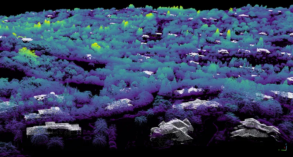
Wildfires that burn high in California's Sierra Nevada can either add to or cut into the snowpack that later melts into the state's water supply. Which way it goes depends on the weather and the lay of the land, according to a peer-reviewed study published by IOP Publishing. The researchers used airborne lidar surveys from 2023 and 2024 to measure how fires in 2020–2021 changed peak snow water equivalent across six watersheds. Lidar maps the ground by bouncing laser pulses off it, and peak snow water equivalent is the most water the snowpack holds in a season.
The team compared more than 32000 pairs of 50 m pixels. Each pair matched a burned patch with an unburned patch that had similar conditions before the fire. The largest gain came in 2023: burned areas in dense forests with at least 75% canopy loss at intermediate elevations held on average 13.0 cm more peak snow water equivalent than matched unburned areas, about 12% more than the 105.1 cm average of those unburned matches. That advantage was substantially smaller in 2024.
A machine learning model called XGBoost found that terrain carried the most predictive information, with vegetation structure second. Burned sites that got less heat, sat lower than their immediate surroundings or were at intermediate elevations tended to hold more snow than their unburned matches. Burned sites that had taller trees before the fire, or that sat on exposed, high-energy slopes, tended to hold less.
The researchers conclude that the effect of fire on snow is strongly context dependent. They present their approach as a framework for predicting where high-elevation fires may boost or shrink mountain snow storage.
Why it matters
Snowpack is a major source of California's water supply, and high-elevation wildfires are increasing. Knowing where burned areas gain or lose stored snow could help with water planning.
What we don't know yet
The results varied in size and direction from year to year and from site to site: the largest gain, seen in 2023, was substantially smaller in 2024. The authors also note that field observations and process models are limited in rugged mountain terrain.
Terms in this story
- Snow water equivalent
- The depth of water you would get if a snowpack melted completely.
- Lidar
- A remote-sensing method that maps surfaces by timing laser pulses that bounce back to the instrument.
- XGBoost
- A widely used machine learning method that combines many simple decision trees to make predictions.
Sources and verification
DexScience articles are produced with AI assistance and an automated fact-check against the linked sources. Spotted an error? Tell us and we will correct it openly.